
Google's latest app uses Maps to let you traverse the Himalayas as Verne the Yeti

Want to run around the Himalayas as the legendary, fuzzy Yeti? You can in Google’s latest app, Verne: The Himalayas.

Google’s Creative Labs is utilizing the vast collection of 3D imagery from Google Maps for educational purposes. The new experimental app lets kids run around the Himalayas and learn more information about the area through points of interests.

“A few of us started wondering if this 3D imagery could make learning about the world a bit more fun for kids,” write Amar Gandhi and J.R. Schmidt from Google’s Creative Labs. “We started playing with quick prototypes, and even brainstormed with our own kids to get inspired by their sense of curiosity.”

In the app, you control Verne, the Yeti named after Jules Verne, via a virtual joystick; a second virtual button makes him jump. All you do is run around the Himalayan landscape, which is made from the 3D images used in Google Maps.

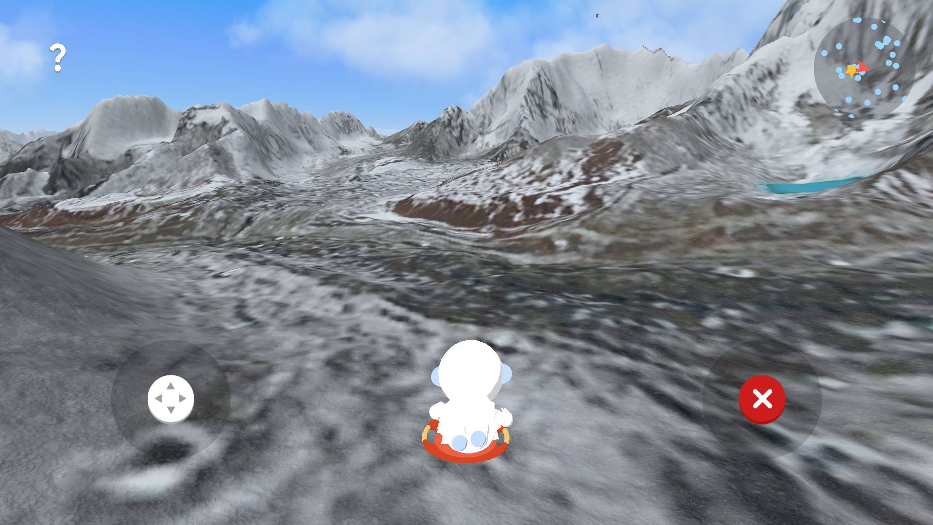
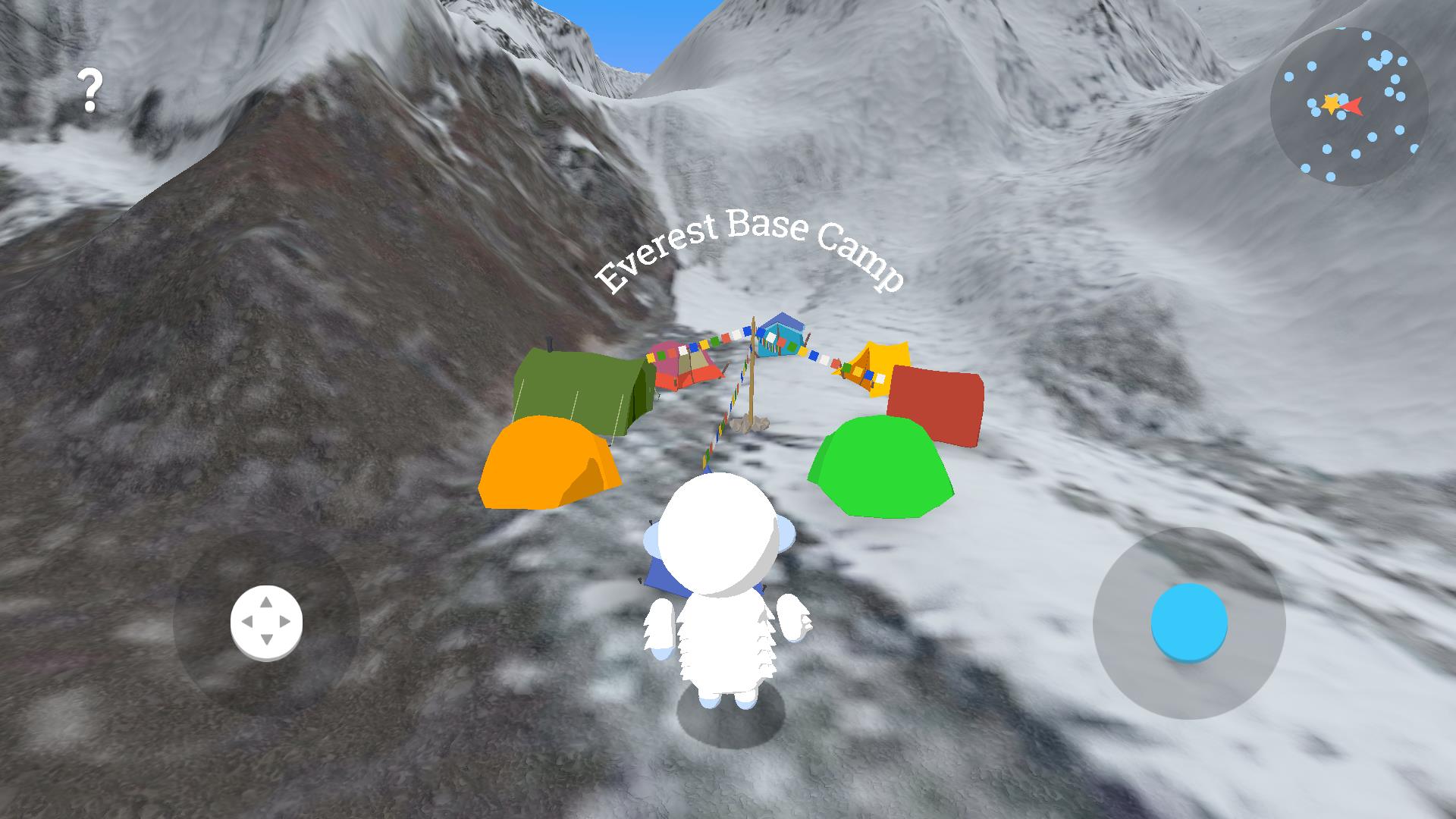
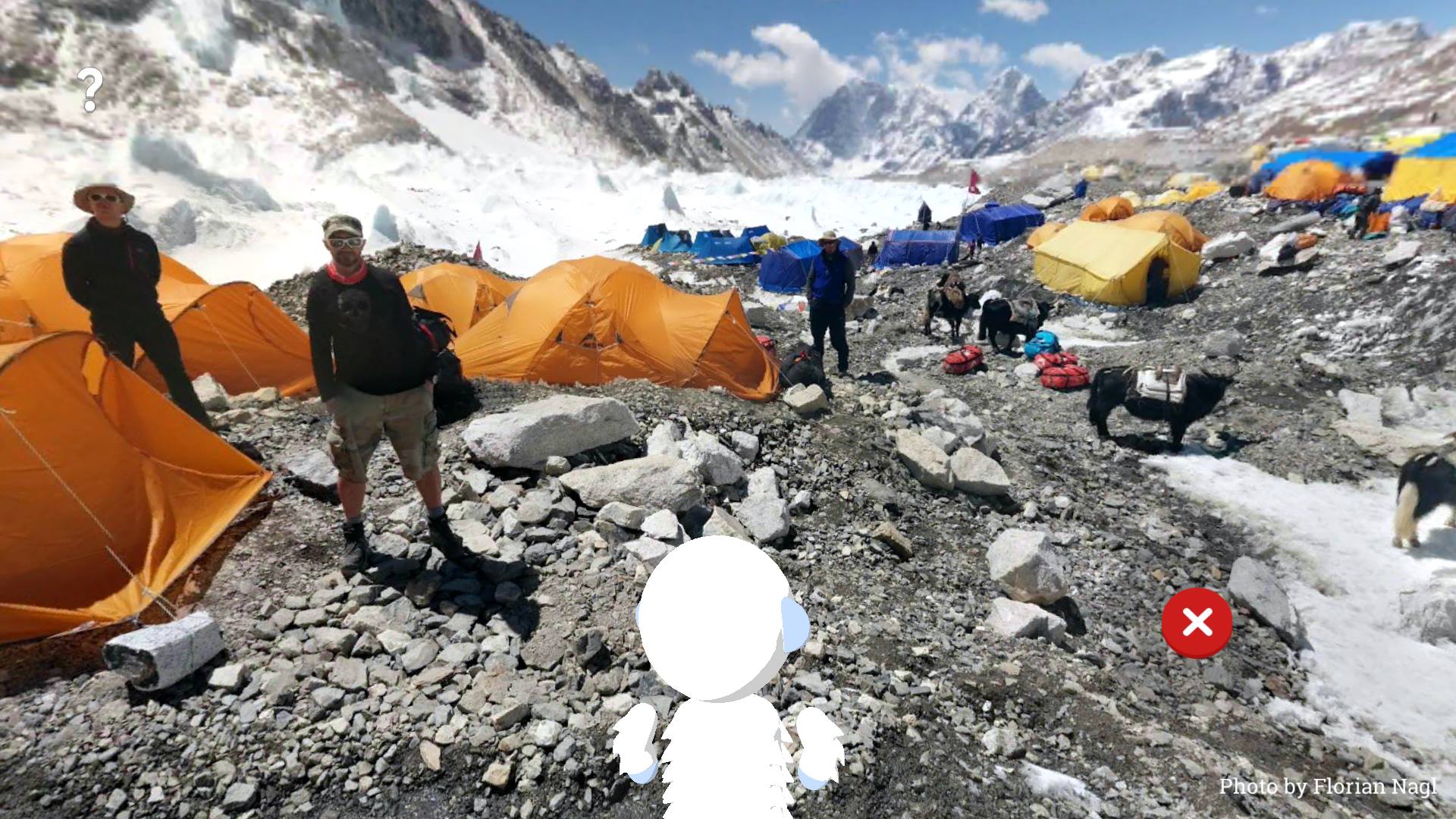
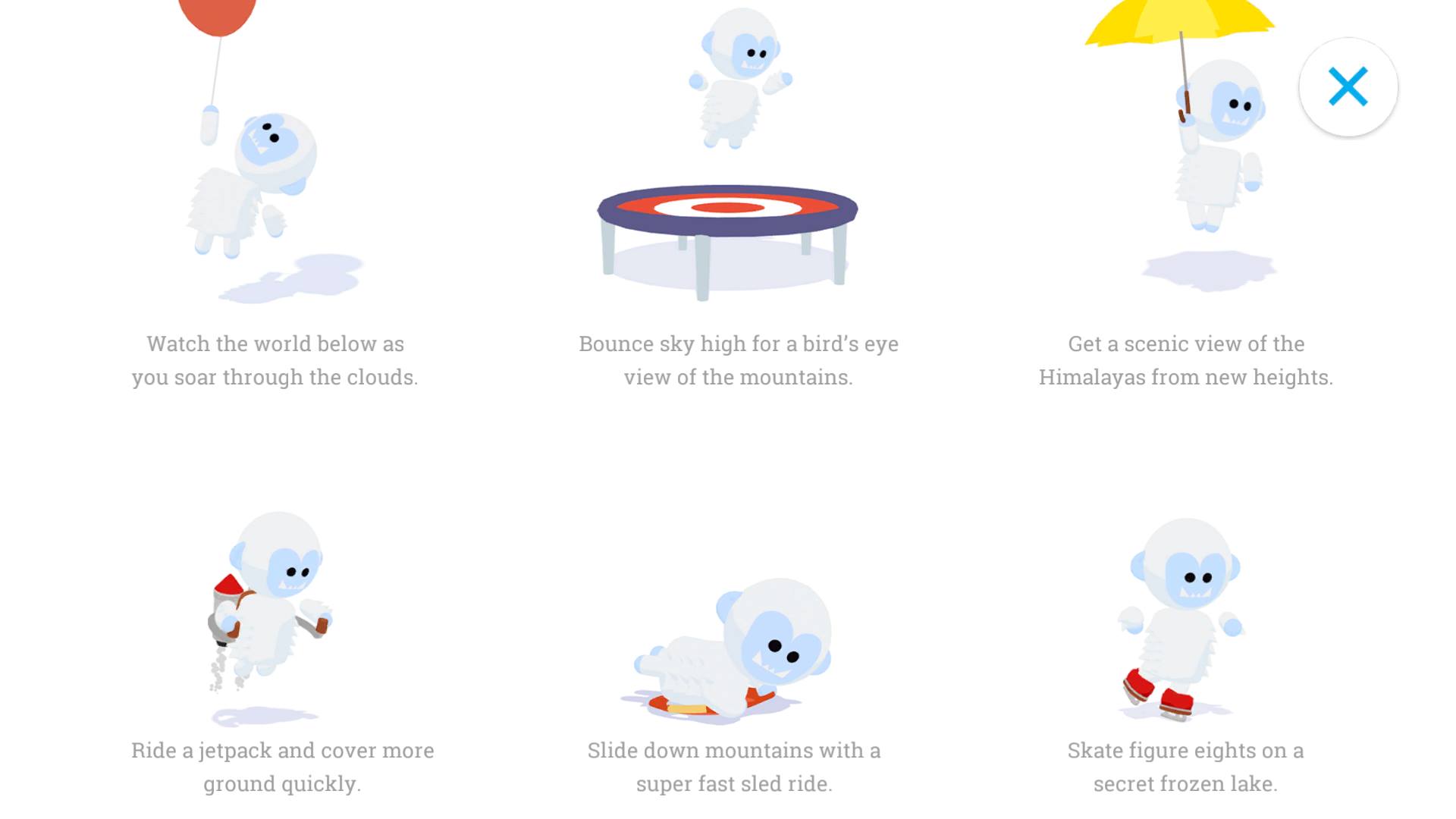
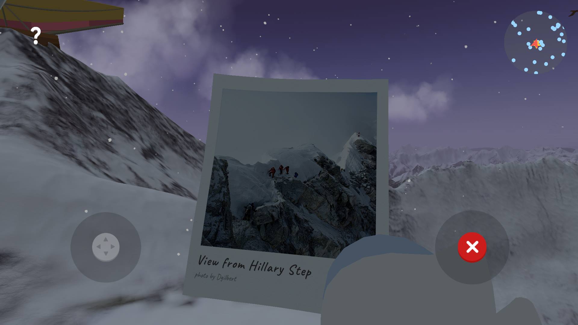
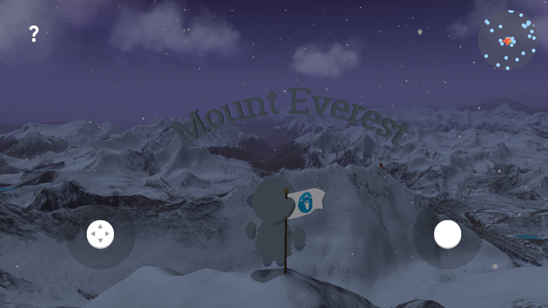
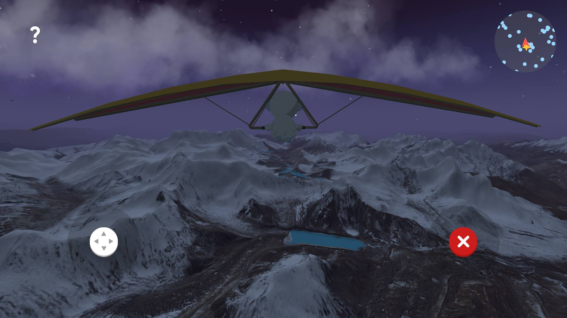
There are all sorts of points of interests, and they’re easy to find thanks to the minimap on the top right. Points of interest include: Photographs from vistas such as the Hillary Step; jet packs you can fly around with; hang gliders; balloons that lift you up for amazing views; 360-photos such as ones from the Everest Base Camp; poles with speakers that offer relevant information; and more.

It’s a fun way to learn a little more about the Himalayas while actively exploring it. The video Google released touting the app hints at expansions for other territories, so it’s likely we’ll see Verne hitting new sites around the world over time. These expansions may depend on the popularity of the app.

The educational app is only available on Android, and you can download it from the Google Play Store now.

Editors' Recommendations

Julian Chokkattu
Former Digital Trends Contributor
Julian is the mobile and wearables editor at Digital Trends, covering smartphones, fitness trackers, smartwatches, and more…
Google Maps is adding new shopping tools for the holiday season
Person using Google Maps on a smartphone.

Google has announced several new features in Google Maps to keep you sane this holiday season by helping you avoid crowds, find your way around the malls, and even get your holiday dinner shopping done.

First off, Google is expanding its crowdedness data features for public transit and specific stores into a broader tool that it's calling "Area Busyness." This will show you how many folks are gathering in a specific neighborhood, rather than an individual store. As Google explains, you can use this information however you like, whether you want to steer clear of the crowds or seek out the hottest spots in town.

Read more
Windows 11 is blocking an app that lets you switch browsers to Google Chrome
Empty folders on Windows 11.

Windows 11 is now blocking the popular app EdgeDeflector, which provides better ability to select alternative web browsers.

The discovery was made in a new build of Windows 11 through the Insider Program, where Microsoft is now blocking applications that sidestep certain restrictions to change web browsers within the operating system.

Read more
Google Maps expands super-useful feature for mass transit
A subway train in New York City.

Google Maps has announced a significant expansion of a handy feature that lets you see how crowded your train or bus is likely to be when it arrives.

After launching the feature in 200 cities in June 2019, the web giant is this week rolling it out to 10,000 transit agencies in 100 countries. If available, the data will appear when you look up transit directions.

Read more